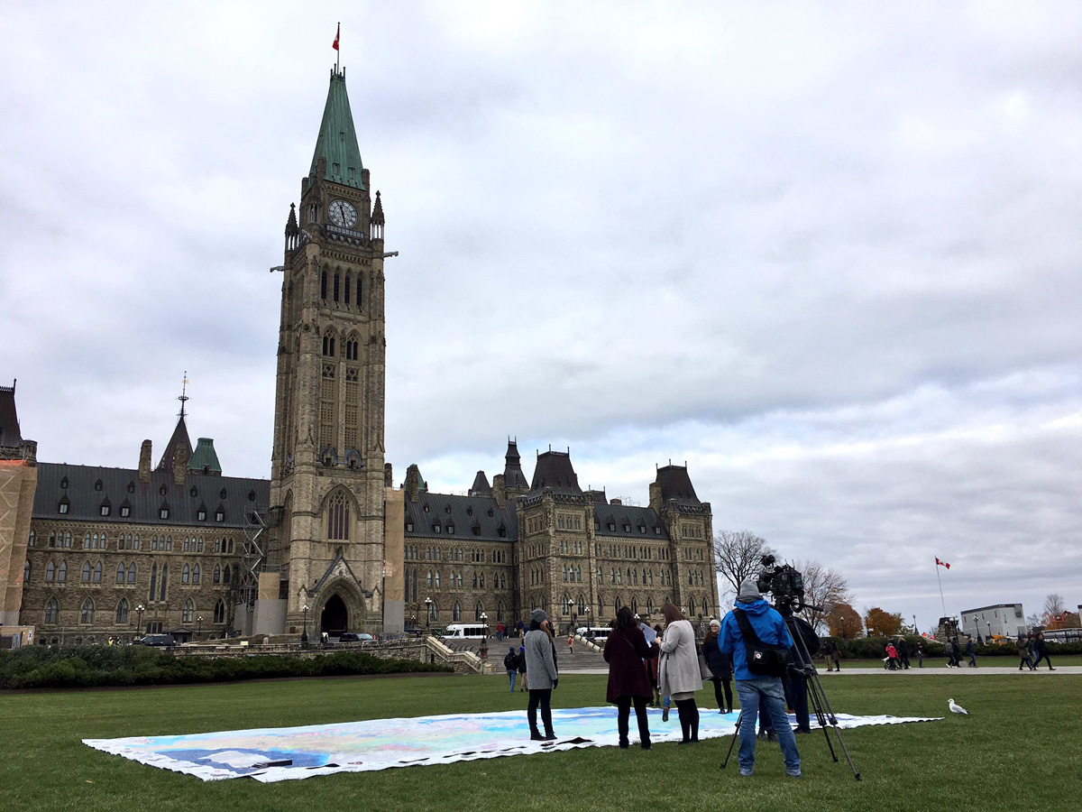
Canadian Geographic Education released a very special project yesterday on Parliament Hill in Ottawa; The Indigenous Peoples of Canada Atlas, an educational resource created by Inuit Tapiriit Kanatami, The Metis National Council, Indspire, The National Centre for Truth and Reconciliation, The Assembly of First Nations, & The Royal Canadian Geographic Society.
A total of 45 were produced in our Edmonton facility and will be touring Canadian schools & events in the near future. Follow the hashtag #IndigAtlas on Twitter, Instagram & Facebook to find out when and where you might be able to examine the incredible detail and hard work put into organizing this valuable piece of Canadian history.
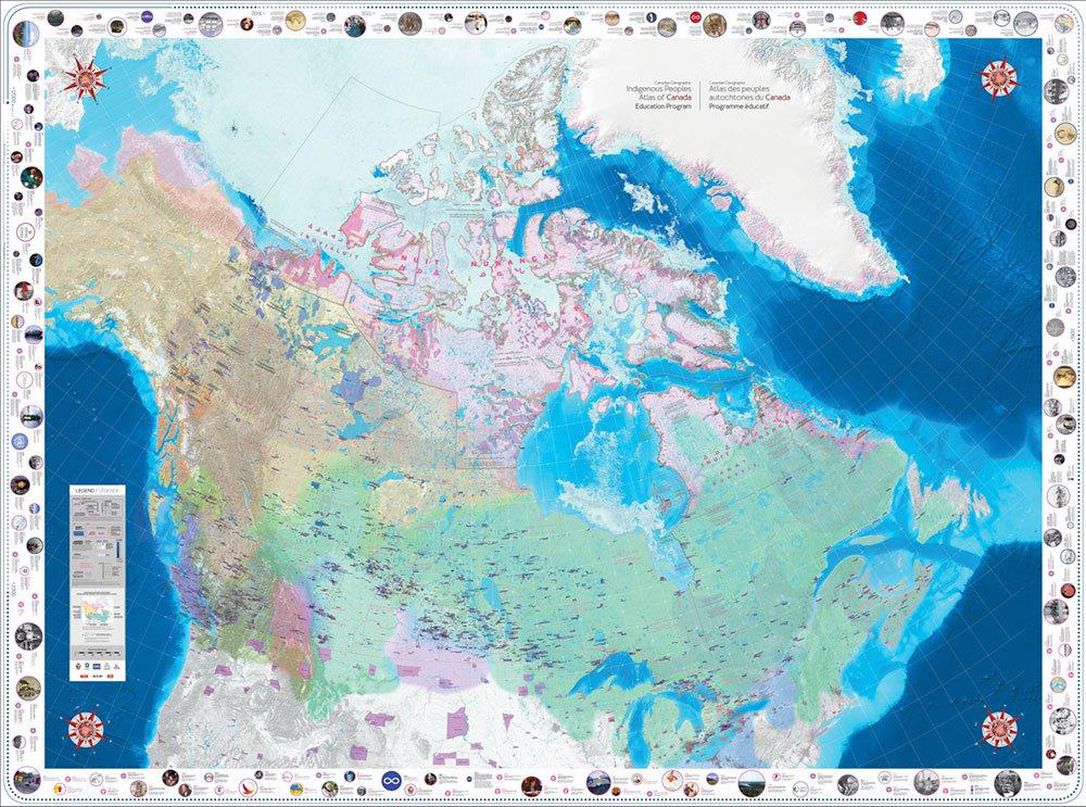
Below are some tweets & press from the event in Ottawa, along with a low resolution flat-view of the 35′ x 26′ walk-able map. Featured image above c/o Canadian Geographic’s Editor-in-Chief, @AaronKylie
UPDATE (11.15.18) – #INDIGATLAS in use at school!
It has been an honour hosting @CanGeoEdu Indigenous Peoples Atlas of Canada giant floor map for 7days. Our students had opportunities to deepen their understanding of the Inuit, Metis and First Nations people using this 8x11m resource. @CanGeo #indigAtlas @RCGS_SGRC pic.twitter.com/koMEW6bIbB
— Learning Commons (@EdgemontLCcbe) November 14, 2018
Yesterday, I was pleased to launch the Indigenous Peoples Atlas of Canada!
I would like to encourage everyone to get involved in learning more about our history, and that of our Indigenous Peoples with #IndigAtlas. pic.twitter.com/SYJ9QUpUFp
— Vance Badawey M.P. (@VBadawey) October 23, 2018
Great to see many of my colleagues exploring the Indigenous Peoples Atlas of Canada Giant Floor Map this morning on Parliament Hill. This Atlas helps tell Indigenous stories and history, promoting education and reconciliation in Canada. #IndigAtlas pic.twitter.com/hSyCrgm3hf
— Vance Badawey M.P. (@VBadawey) October 22, 2018
It was incredible to learn about our Indigenous History through a massive map of all Indigenous territory across Canada. Thanks to @CanGeo @RCGS_SGRC @VBadawey for bringinging #indigatlas to the Hill! #indigenoushistory pic.twitter.com/XkNCkwbolk
— Churence Rogers, M.P. (@ChurenceRogers) October 22, 2018
The Indigenous Peoples Atlas of Canada and Giant Floor Map are amazing learning resources. I was happy to attend the launch today on Parliament Hill #IndigAtlas pic.twitter.com/4iUIqJdYdW
— Julie Dabrusin (@juliedabrusin) October 22, 2018
The Indigenous Peoples Atlas of Canada educational resources are being launched on Parliament Hill today! #IndigAtlas is a product of all the hard work from @ITK_CanadaInuit @MNC_Tweets @Indspire @NCTR_UM @AFN_Updates and @RCGS_SGRC pic.twitter.com/y8ZVFtwtMc
— Tanya Kirnishni (@TanyaKirnishni) October 22, 2018
.@CanGeoEdu launches the Indigenous Peoples Atlas of Canada Giant Floor Map on #ParliamentHill today #indigatlas pic.twitter.com/tuKLRGfsT9
— Aaron Kylie (@aaronkylie) October 22, 2018